 |
eClassroom Journal for Minnesota |
 |
|
eClassroom Journal for Minnesota |
|
| Click on any outlined image to see a larger version of the image.
Anywhere you see a | |
| Previous state (North Dakota) | Next state (Wisconsin) |
| August 5, 2000 Lake Itasca, Minnesota
|
Headwaters of the Mississippi
Please see the August 5, 2000 entry in Flat Teddy's Journal. |
| August 8, 2000 Lake of the Woods, Minnesota
|
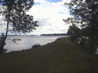
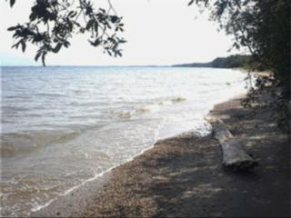 Lake of the Woods
Lake of the Woods, between Minnesota and two provinces of Canada, is one of the world's largest lakes. It is ocean-like in its size and moods. It has 65,000 miles of shoreline and 14,000 islands! Where this picture was taken at Zippel Bay at the south end of the lake it's 80 miles across to the northern tip of the lake! It is 55 miles across at its widest. You are seeing the lake on a calm day, when the waves were lapping mildly at the sandy shoreline. On stormy, windy days the waves crash in like the ocean surf, and they can be very high and dangerous. Up on the west side of the lake, sticking out on a large peninsula, is an area of the United States called the Northwest Angle. The only land it is connected to is in Manitoba, Canada, and the only way to get to it without going through Canada is by boat. The "angle" is the result of the Treaty of Paris in 1783, when the United States Revolutionary War was over and the United States was setting the Canadian boundary with England. The language of the treaty stated that the northwest corner of the Lake of the Woods would belong to the United States. But how do you determine the northwest corner of a lake so irregular in shape? The wording resulted in fifty years of controversy that ended in 1842 when a treaty between the United States and Britain officially established the present boundary between the two countries. |
| August 9, 2000 Voyageurs National Park, near International Falls, Minnesota |
The Voyageurs
Please see the August 9, 2000 entry in Flat Teddy's Journal. |
| August 9, 2000 Voyageurs National Park, near International Falls, Minnesota
|
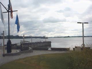
 Rainy Lake, Voyageurs National Park
Voyageurs National Park
Find Rainy Lake on a map and compare its size to that of Lake of the Woods. The Voyageurs used both lakes to transport beaver pelts. Which lake would have taken them the longest to cross? The route of the Voyageurs through Rainy Lake became so established that
the 1783 treaty ending the American
Revolution
|
| August 9, 2000 Voyageurs National Park, Minnesota
|
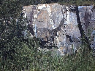 Rocks in northern Minnesota
Picture: 2.7 billion year old rock Voyageurs National Park lies in the southern portion of the Canadian Shield. The ancient sediments that comprise the shield represent some of the oldest rock formations exposed anywhere in the world. Younger rock formations do not appear here. Perhaps they never existed, but more likely glaciation simply removed them. At least four times in the past one million years, continental glaciers--ice sheets two miles thick--bulldozed their way through the area. They removed previous features, leaving mostly level, pock-marked rock up to 2.7 billion years old. Hundreds of ponds, lakes, and streams now nestle in the depressions, and some rock surfaces in the park still bear the scrape marks. Why could we say that the Voyageurs Highway through all these lakes was actually a gift of the glaciers? |
| Previous state (North Dakota) | Next state (Wisconsin) |
|
Links Back to the main page... |